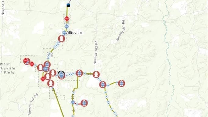
When broadband construction was scheduled to begin in the small town of Willisville, Arkansas, located in Nevada County, local leaders knew one thing immediately: installing fiber would be much safer if the town’s underground utilities were accurately mapped.
But the effort to prepare Willisville for fiber began well before construction crews arrived.
Over the past year, the City of Willisville had been working with the Broadband Team at Communities Unlimited (CU), including Technical Assistance Providers Katy Parrish and Ali Milligan, through the USDA-supported Broadband Technical Assistance (BTA) program. The two-year initiative, running from 2025 through 2027, helps rural communities plan and prepare for broadband expansion.
CU began working with Willisville in May 2025 through the Nevada County Broadband Committee, a regional effort that includes nearby communities such as Prescott and Rosston. Through planning meetings and regional collaboration, CU staff helped local leaders understand what fiber deployment would require and how the community could prepare.
“Once Communities Unlimited came into the picture, things started moving quickly. We had meetings about what to expect and what the community needed to do, and once they got involved everything just started rolling along smoothly.”

— Christy Burney, Willisville Mayor
During those early discussions, Mayor Burney raised a concern that would soon shape the next phase of the project: the location of Willisville’s water lines. Parrish recognized the risk immediately and referred the city to CU’s Geographic Information Systems (GIS) Team.
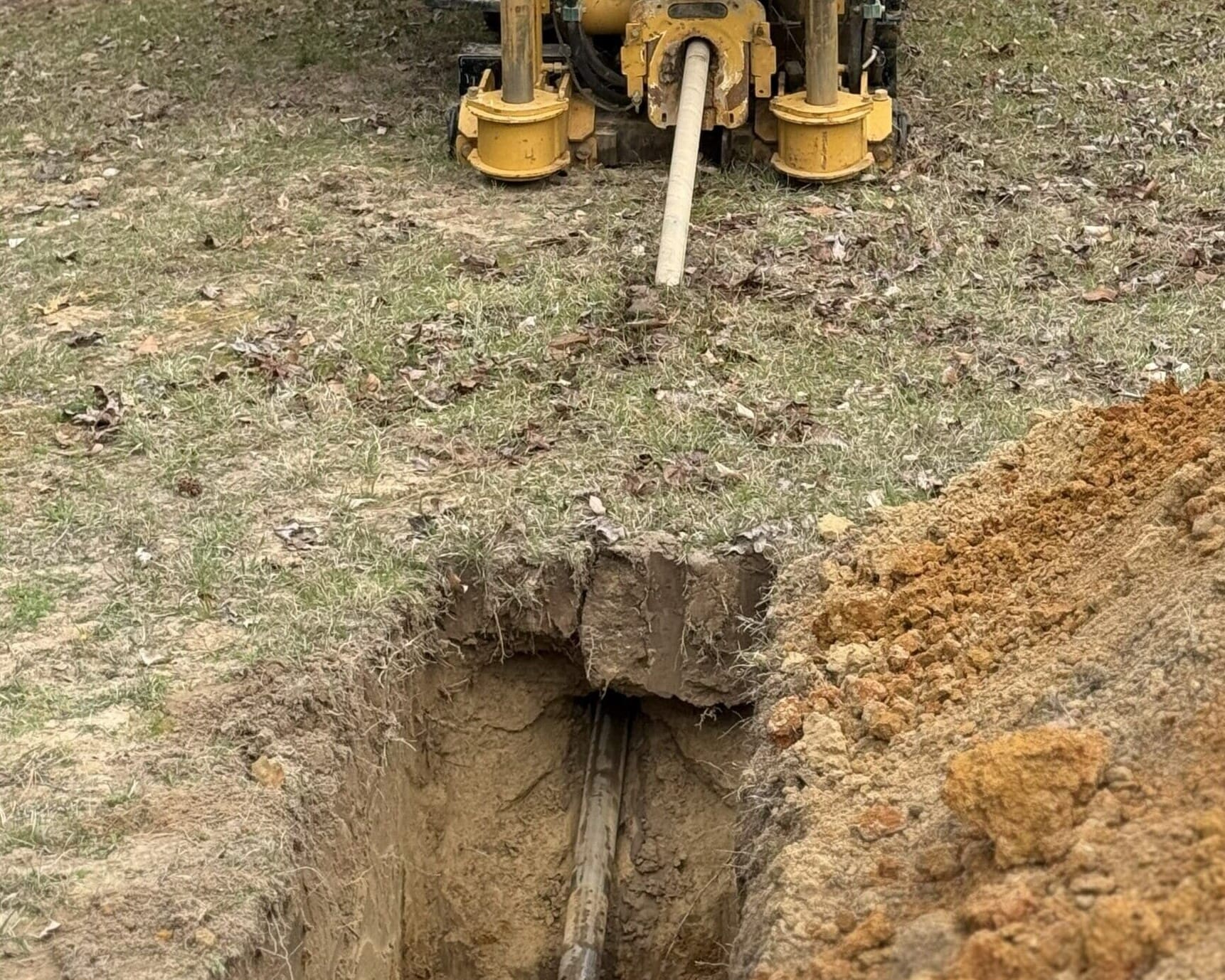
The need for accurate mapping was clear. Without reliable utility data, excavators installing fiber risk striking buried water lines — potentially causing service outages, costly emergency repairs, and delays to broadband construction.
In January 2026, Willisville formally reached out to the GIS Team for help mapping its water system infrastructure before fiber installation began.
At the same time, Willisville faced another challenge: the town’s water system had not been accurately mapped in decades. Mayor Burney explained that the only records available dated back to original blueprints created in 1983 — and many of those drawings were unreliable.
“From experience, I know some of those prints weren’t correct. They might say a line goes one place, but in reality it doesn’t. So having Communities Unlimited come in and map our water system was a godsend.”
— Mayor Burney
From there, GIS Specialist Harrison Brown deployed to Willisville on February 24 and immediately began mapping the town’s water system alongside the mayor and Milligan.
While the work resembles a typical water infrastructure mapping project, broadband preparation requires a higher level of precision. The goal is not just documenting infrastructure but ensuring contractors can safely excavate during fiber installation.
Using multi-band Global Navigation Satellite Systems (GNSS) positioning equipment mounted on surveying poles, the team collected highly accurate location points. Many measurements were enhanced using real-time kinematic (RTK) corrections delivered through a web-based system, allowing accuracy down to roughly 5–25 centimeters.
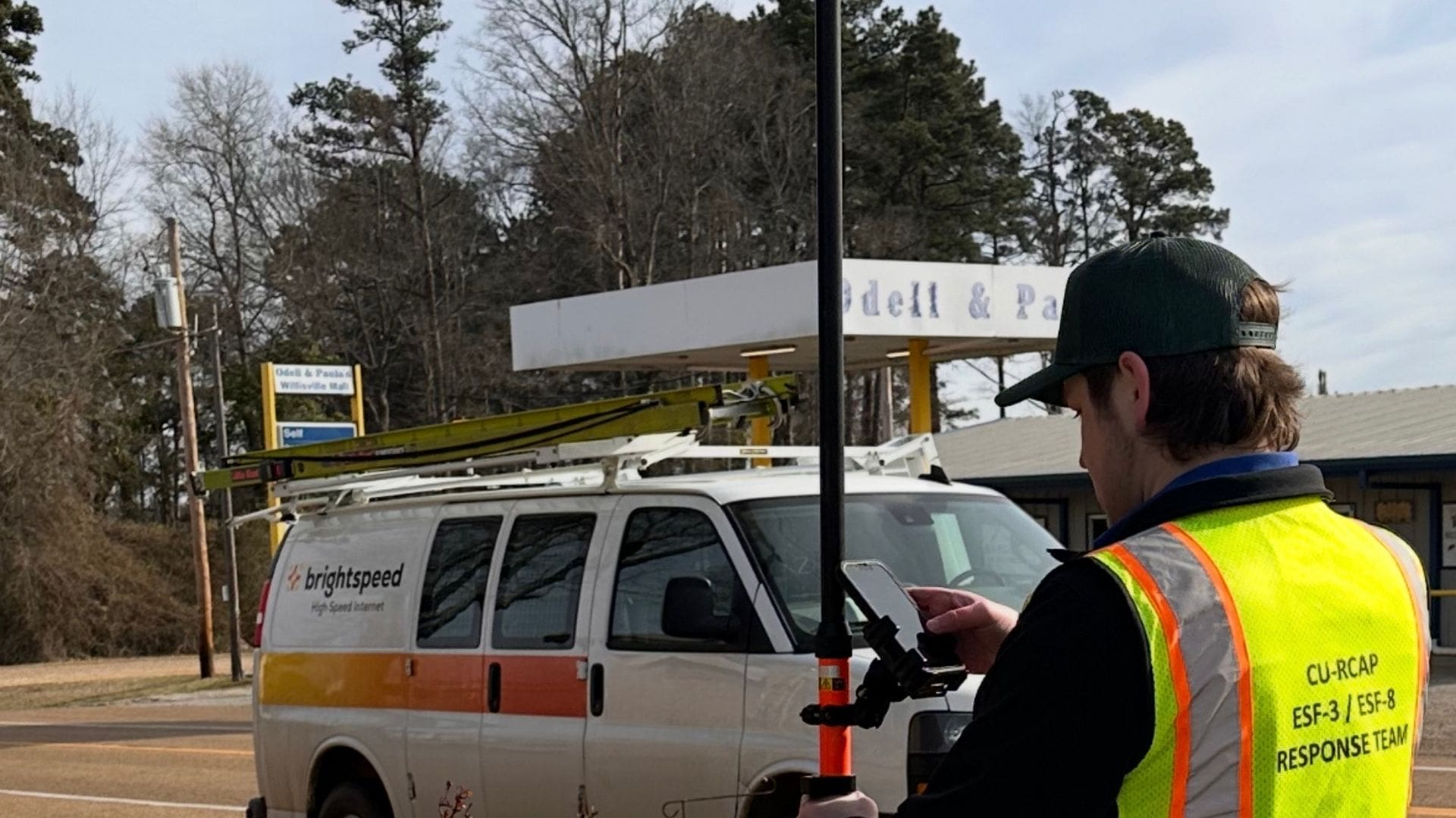
Brown also identified where water lines were buried and which side of the road they ran along — critical information for construction crews working near underground infrastructure.
These detailed digital maps give contractors a clear picture of what lies below the surface before excavation begins, significantly reducing the chances of broken lines, service disruptions, or costly repairs during fiber installation.
Burney said the speed of the mapping process impressed her.
“It was incredibly fast,” Burney said. “The turnaround was amazing. I can’t recommend (Communities Unlimited) highly enough.”
Within three days in the field, Brown completed the mapping work. The finished GIS system — along with wall maps and portable field maps — was delivered directly to the broadband contractor ahead of construction, which began on March 2.
Burney quickly shared the maps with the crews installing fiber.
“That same Thursday after Harrison showed me how everything worked, I had the maps in the contractors’ hands within an hour,” Burney said. “They were excited to have them.”
Since receiving the maps, Burney said the construction crews have been able to work without damaging the town’s water infrastructure.
“We haven’t had any problems at all,” Burney said. “Nobody has hit a water line. They’re able to see where everything is and work around it. That’s been a blessing.”
For Willisville — a town of roughly 145 residents within city limits and about 190 people served by the municipal water system — the arrival of fiber internet represents a major step forward.
Burney said many residents previously struggled with limited internet access. Some even had to drive long distances just to get online.
“In the past, people have had to sit in the school parking lot to use Wi-Fi or drive about 40 minutes to the Nevada County Library just to get internet access,” Burney said. “During COVID especially, it was a real challenge.”
Even city officials experienced the limitations firsthand. Burney said City Hall previously could not obtain internet service because the local provider had no available Digital Subscriber Line (DSL) connections.
“At my own house, I was getting about 1.25 megabits per second,” Burney said. “We’ve already switched over to fiber at 200 megabits per second. It’s made a world of difference.”
For Burney, the progress is especially meaningful. She represents a long line of community leadership in Willisville — serving as the town’s third-generation mayor, following both her mother and her grandfather in the role.
She said the combination of fiber connectivity — expected to be completed by mid-March — and modern GIS mapping will benefit Willisville long after construction crews leave.
“We’re small, but having reliable internet opens a lot of opportunities for residents,” Mayor Burney said. “And the GIS mapping is just as important. Long after I’m gone and new leadership takes over, they’ll know exactly where the water lines, valves, and hydrants are located.”
"It’s something that will benefit Willisville for years to come.”
— Mayor Burney