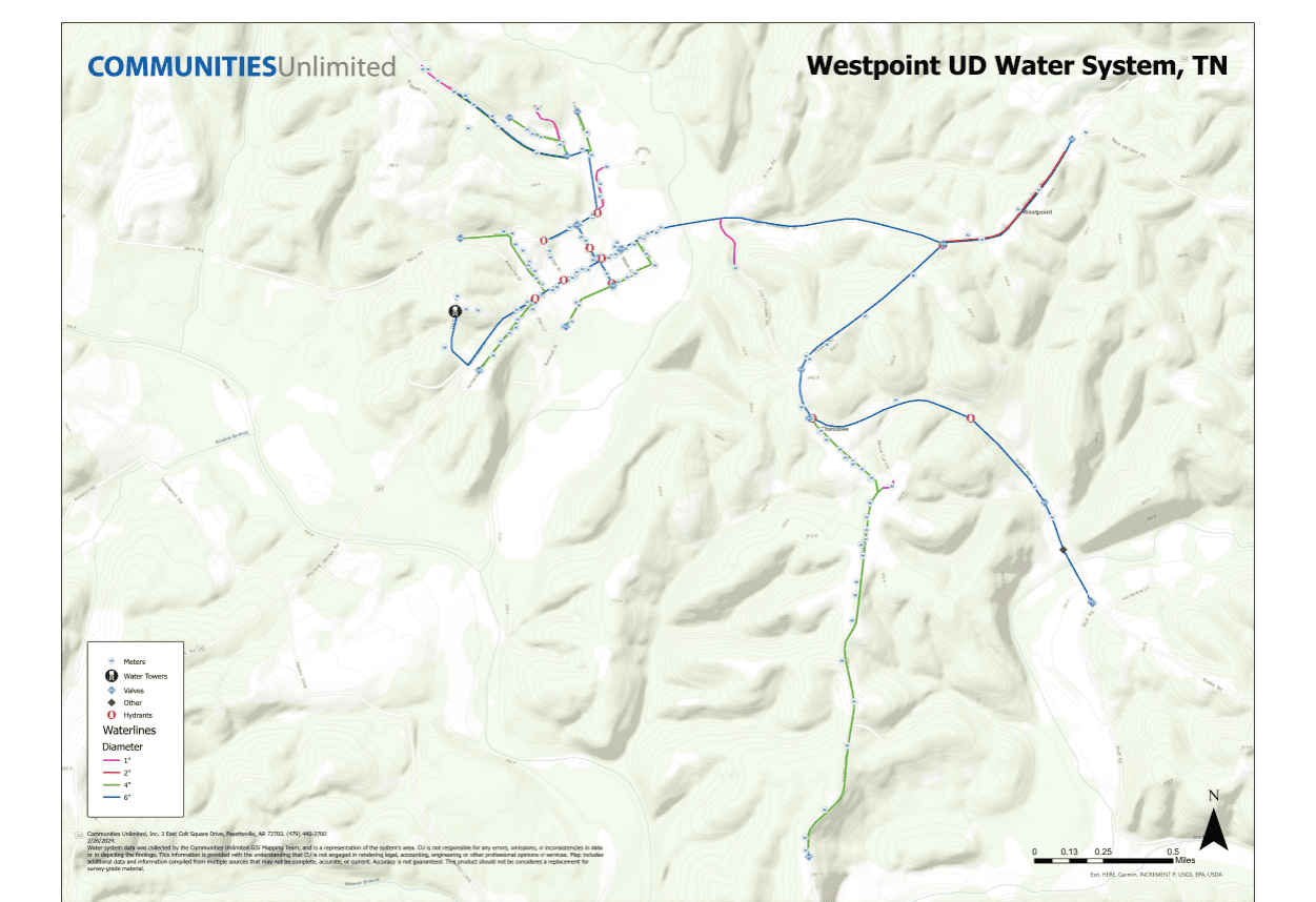
The Tennessee Department of Environment and Conservation (TDEC) requires utility systems to maintain detailed maps documenting every aspect of their infrastructure, from water meters and valves to hydrants and pipe types.
For the West Point Utility District (UD), a small unincorporated community in Lawrence County, Tennessee, the last map update occurred in 2009. Although minimal changes had been made to the system since then, an updated map was essential — not only to comply with state regulations but also to address pressing infrastructure issues.
GIS mapping is a crucial tool for visualizing a water system’s infrastructure. While water operators may have a mental map from years of experience, a physical, up-to-date map provides a far clearer and more actionable picture of the system’s geographic and spatial layout. In West Point UD’s case, the outdated map was repeatedly flagged during sanitary surveys, highlighting the critical need for a comprehensive update.
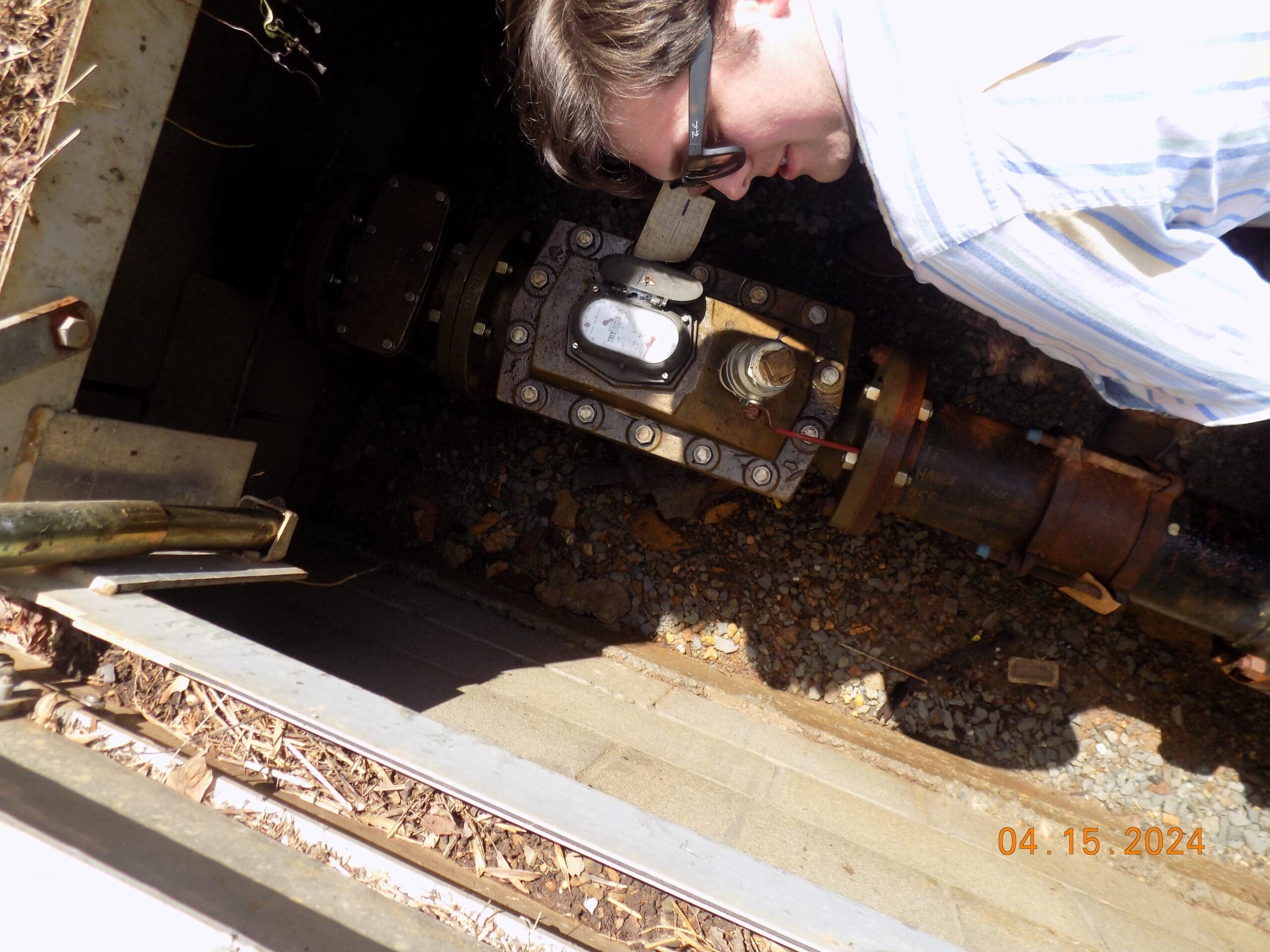
Communities Unlimited’s (CU) Geographic Information System (GIS) mapping service stepped up to fill this gap, led by Tennessee State Coordinator Annie Chiodo and Source Water Project Manager Brett Capps from the Community Infrastructure Team. By February 2024, field mapping was underway, with CU GIS Project Manager Trent Neathery joining the effort. The project quickly revealed the full extent of the system’s neglect, with components like valves and pipes showing significant signs of wear and disrepair.
The updated GIS map became an indispensable tool for West Point UD, not just for routine maintenance but for addressing deeper infrastructure issues that had gone unresolved for years. For instance, mapping frequent repairs in one area could highlight the need for line replacements due to shifting soil or pressure problems — issues that might remain hidden without a clear, visual representation of the system.
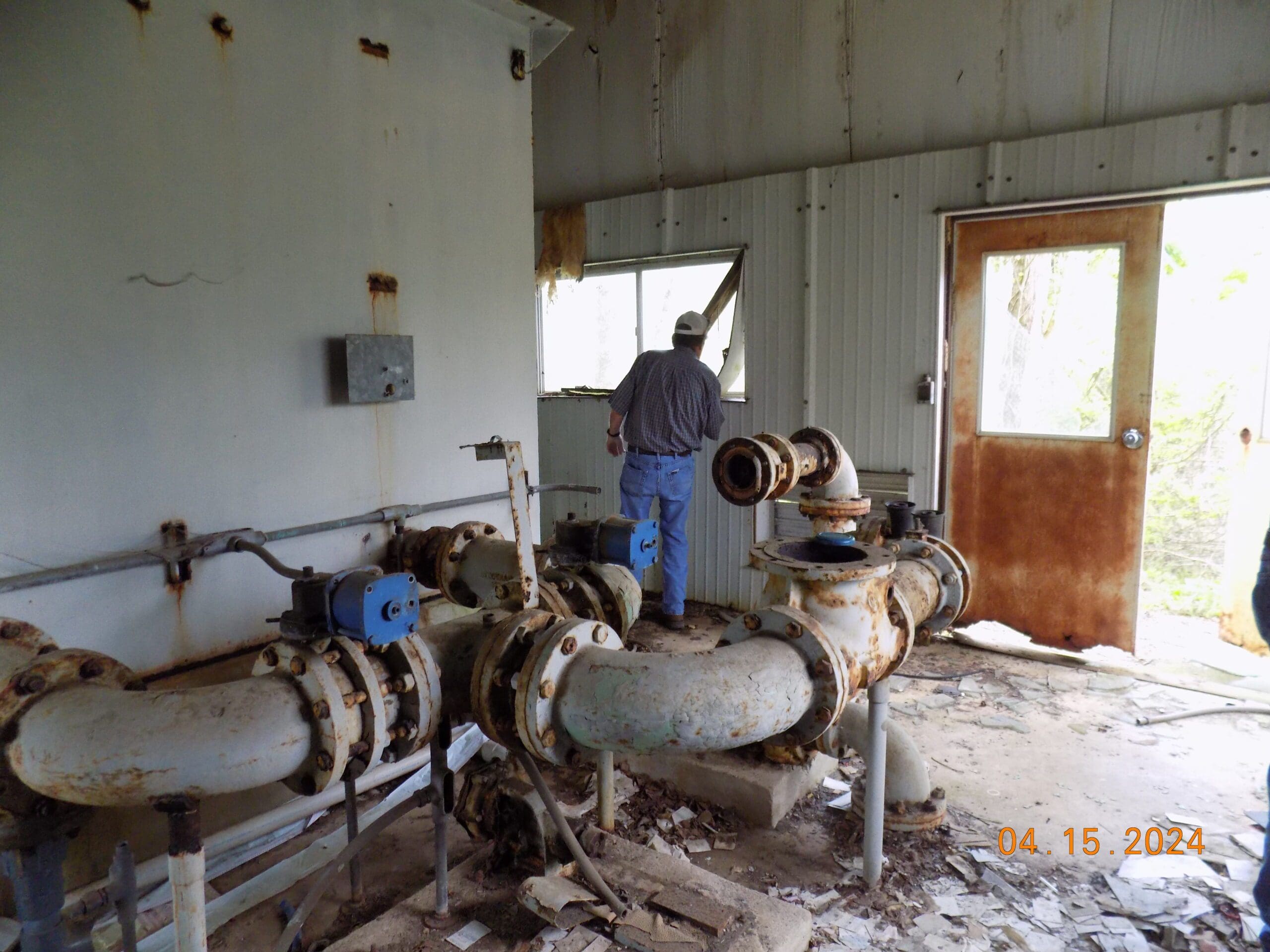
In West Point’s case, where the infrastructure was severely degraded, the GIS map provided a detailed overview that was essential for future planning. The new map included pipe sizes, line lengths, and a full inventory of assets, giving both current operators and any potential new management a comprehensive understanding of the system. This clarity was vital for making informed decisions and ensuring a smooth transition if another entity were to take over operations.
GIS mapping also facilitates easy data sharing among engineering teams, making it an essential tool for communities to manage their infrastructure effectively. Even in West Point, where the computer infrastructure is less advanced, the GIS data played a crucial role in engineering studies, helping to address broader infrastructure challenges.
“For West Point, there are a lot of moving parts,” Capps said. “They’re like many small systems, facing multiple infrastructure needs at once, trying to address issues that should have been dealt with over the past decade. The GIS mapping was a catalyst, the first step in addressing these broader projects.”
Neathery echoed the importance of this work, noting that updated maps are not just a regulatory requirement — they’re essential for the long-term health of any water system.
“It brings a smile to my face knowing that in some way, I had a hand in making someone’s life better and improving their quality of life. I’m excited to be part of an organization that does work like this — it’s good work that truly improves people’s lives.”
— Trent Neathery, CU GIS Project Manager
West Point UD’s experience highlights the importance of GIS mapping as a powerful tool for addressing infrastructure issues. Without an updated map, the community’s ability to manage and maintain its water system would have been severely compromised.
This project serves as a clear example of how essential GIS maps are for ensuring the long-term viability and effectiveness of rural water systems.