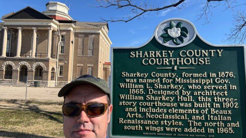
When an EF-4 tornado tore through Rolling Fork, Mississippi, located in Jones County, on March 24, 2023, it left behind catastrophic destruction. The town’s city hall, police station, county courthouse, post office, and iconic water tower were among the many structures lost in the storm. Over 85% of the community’s infrastructure was damaged — most of it beyond repair. Homes were blown off their foundations, and underground water and wastewater systems were left in disarray. For the town’s residents, the tornado wasn’t just a natural disaster — it was a life-altering event.
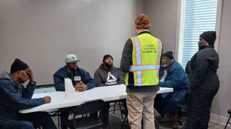
Communities Unlimited (CU) stepped in as a key partner in Rolling Fork’s recovery, leveraging its Geographic Information Systems (GIS) expertise to help the community rebuild. Led by GIS Coordinator Don Becker and Training Project Manager Lorraine Magee with the Community Infrastructure Team, CU’s project not only created infrastructure maps but also supported long-term disaster recovery and resilience.
CU’s involvement began thanks to Mississippi State Coordinator Shannon McCranie, who first connected with local leaders. Her assistance allowed CU to gain approval from Rolling Fork Mayor Eldridge Walker and the city board, enabling Don and Lorraine to initiate field data collection and mapping efforts. With no existing system maps available, CU’s work was crucial to identifying infrastructure vulnerabilities and developing a roadmap for repairs.
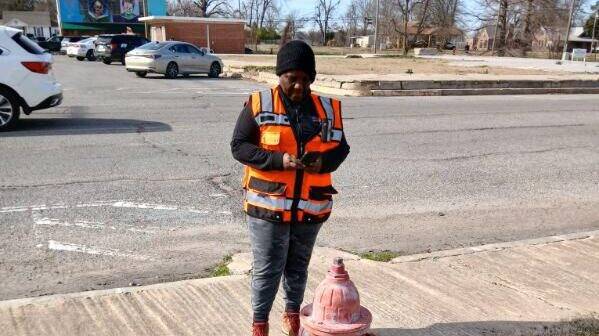
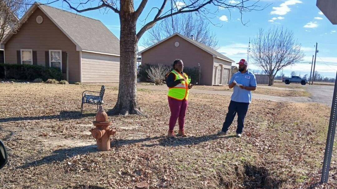
Don and Lorraine’s January 2025 visit to Rolling Fork was pivotal. Working alongside city staff in a temporary building — the original city hall having been destroyed — the team mapped 858 customer connections, 140 hydrants, 141 valves, and 19 additional features in the town’s water system.
Ken Roberts, Utility Supervisor for Rolling Fork, highlighted the importance of this effort.
“We lost all the maps and records in the storm. The GIS mapping was something we really needed, and we plan to go back and get more help. The mayor even sent a letter asking if you could assist with mapping our sewer system, developing a five-year and 10-year plan for the water system, and helping us meet compliance standards.”
— Ken Roberts, Utility Supervisor with the City of Rolling Fork
Documenting and Diagnosing Damage
The tornado left extensive underground damage, with water leaks largely repaired but stormwater continuing to infiltrate the wastewater system during normal rain events. Mapping these issues provided a clearer understanding of where repairs were most needed. CU’s work also identified aging clay pipes and outdated water mains, prompting the community to prioritize replacements.
Becker explained that CU’s mapping efforts were supported by archived data from a hydrostatic study conducted in the mid-2000s, secured with the help of Specialist Alex Webb. This data enabled CU to draw in accurate water lines, giving Rolling Fork a more comprehensive view of its infrastructure.
“They’ve provided us with great tools to work with,” Roberts said. “They’re helping us figure out things like how much line we really have, which is critical. Support like this is what’s going to bring us back stronger.”
A Town Steeped in History, Striving for Resilience
Rolling Fork’s rich history added emotional weight to the recovery process. Known as the birthplace of blues legend Muddy Waters and the inspiration for the teddy bear, the town’s cultural landmarks were symbols of its identity. The tornado destroyed many of these, including a statue dedicated to Muddy Waters, though the Teddy Roosevelt and teddy bear installation survived.
Amid the devastation, there were stories of hope. A local restaurant, Chuck’s Dairy Bar, gained national attention for sheltering staff and customers in its walk-in cooler during the tornado. While the building was a total loss, everyone inside survived.
Mayor Walker reflected on the aftermath.
“It’s so hard to put into words, but it was a tough time for this community,” the mayor said. “Right after the storm, we focused on assessing the damage and recovering. The initial effort was recovery — helping those in need of first aid, hospitalization, and medical treatment. And then, tragically, recovering those who died as a result of the tornado.”
The mayor, who also serves as the local funeral director, has personal experience that underscores the emotional and logistical challenges faced by the community. His home was damaged, surrounded by electrical wires, and debris blocked the streets. Despite this, he prioritized helping others, working alongside police and first responders to check on residents.
Progress and New Foundations
Fast forward almost two years and Rolling Fork has come a long way since the tornado. Private homes have been rebuilt, and renters who lost their homes have benefited from organizations that constructed new residences. The iconic water tower is being rebuilt on its original site, and CU’s GIS maps are already proving beneficial in day-to-day operations.
“Now, we can access the GIS data on our phones and computers, and it’s already proving to be very beneficial to our city. Don did an outstanding job putting that together for us. I just signed an agreement for another project with them. From what I’ve seen and heard from other cities they’ve worked with, they do great work. I’m looking forward to seeing them help Rolling Fork in the same way.”
— Eldridge Walker, Mayor of Rolling Fork
CU’s GIS work has had a ripple effect. The mayor and city board are now exploring additional collaborations with Lorraine on the Infrastructure side, including projects related to policy development and long-term infrastructure planning.
“I’m excited about continuing our relationship with Communities Unlimited,” Mayor Walker said.
A Roadmap for Resilience
Mayor Walker praised the collaborative efforts of local and state agencies, highlighting their key role in driving Rolling Fork’s swift recovery so far.
“Rolling Fork wouldn’t be where it is today without the support we’ve received from people inside and outside of Mississippi,” said Mayor Walker. “They’ve helped our families who lost nearly everything. There have been so many moving parts that came together to get us this far, and we’re truly grateful to everyone who played a role in our recovery.”
With CU’s GIS mapping and disaster recovery work, Rolling Fork now has the tools and plans needed to rebuild and strengthen its infrastructure.
Learn more on how CU’s GIS mapping aided Rolling Fork’s recovery. Explore the GIS team’s project summary here.